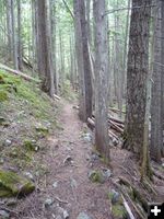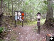
Trailhead
This is the official trailhead for trail #972. You will need to hike almost 2 miles just to get to it.
|
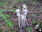
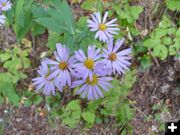
Indian Pipe
Some Indian Pipe wildflowers growing along the trail with some older seed pods in the background.
|
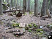
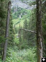
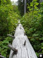
Footbridge
A small foot bridge near the beginning of the trail
|
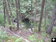
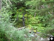
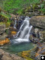
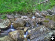
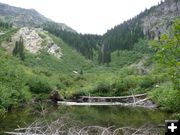
Pool of water
A large pool of water on the river below the trail.
|
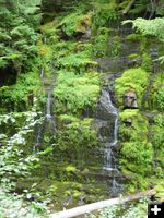
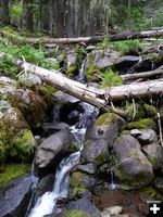
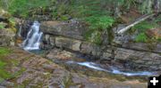
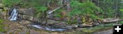
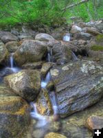
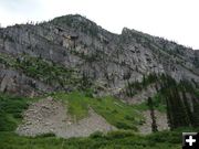
Weeping Walls
Some beautiful moss covered weeping walls along the river.
|
|
Snowshoe Lake hike (from Bull River side)
Photos and trail report by Bob Hosea
September 15, 2010
Recently, Bob Hosea took a hike to Snowshoe Lake, on the northwest side of Snowshoe Peak. This is not part of the Snowshoe Lakes chain of lakes from earlier stories, but rather is coming in from the Bull River side of the Cabinet Mountains.
Bob welcomes comments and questions from people about area hikes. He can be reached by e-mail at: hiking@thebobfactor.com
Here is Bob�s trail report:
=============================================
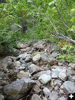
Snowshoe lake is accessed from trail #972 which follows the North fork of Bull river the entire way to the lake. To get to the trailhead, drive south approximately 20 miles on Highway #56 from Troy and then turn left onto the Forest Service road #410. Drive approximately 2 miles and then park near a new bridge that was just built a few weeks ago to span a washout in the road. There is a small parking area on the other side of the bridge that will hold three vehicles. From there you will need to walk two miles up the Forest Service road #2722, which was partially washed out a few years ago and has not yet been repaired. The trailhead is at the end of road #2722.
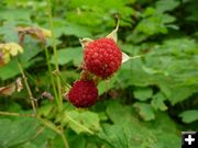
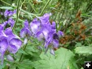
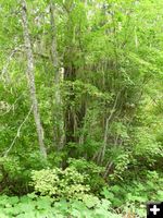
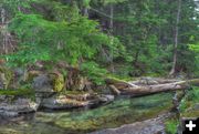
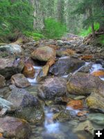
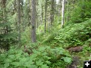
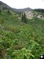
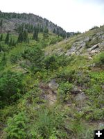
The first few miles of the trail are in pretty good shape and the trail follows the North Fork of Bull river and gives you many great views of the river and the waterfalls on it. There are also many small streams that flow across the trail and down to the river. Along the trail there were many wildflowers growing that included Sticky Aster, Fireweed, Monkshood, Indian Pipes, Queens Cup Bead Lily and many huckleberries and Thimbleberries.
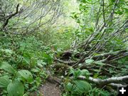
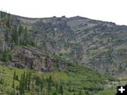
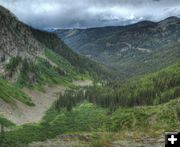
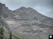
Once you reach Verdun creek, which is about half way to the lake, the trail gets much worse. There were many trees across the trail after Verdun creek and many areas where the trail detours around washed out sections of the trail. The vegetation along the trail also gets much thicker and taller. After you have hiked a little over six miles you will come to an area along a small pond that will give you a view of the last part of your hike, which is a climb up a 900 foot high rocky wall. If you look hard enough on your way up the rocky wall you may find small sections of a trail that you can use. But, for the most part it's pretty much just whatever
works for you to get you to the top.
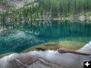
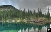
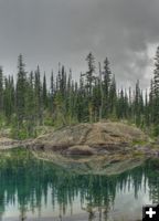
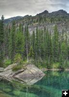
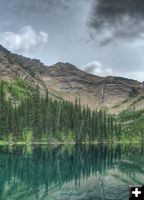
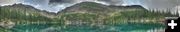
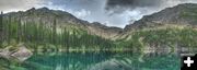
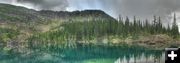
Once you're on top it's a short hike over to the lake and the incredible view that waits for you. From the lake, which is deep blue in color, you have a great view of Snowshoe Peak which is the tallest peak in the Cabinet Mountains at 8738 feet high.
On the day of my hike I spoke with two hikers from Post Falls, Idaho, who had just come down from the peak. They said that while they were on the top of the mountain it started hailing on them and they had to cut their stay on top short and hike back down. I also saw two other local hikers who were setting up camp at the lake.
The hike from the parking area to the lake was over 7 miles and took me 5-1/2 hours. During the hike you will climb approximately 3700 feet in elevation. I didn't see any wildlife along the way and I didn't have any problems with biting bugs at all.
=============================================
Here is a link to the video for this hike:
Snowshoe Lake hike Bob Hosea, August 28, 2010
=============================================
Related Links:
Snowshoe Lakes hike � Bob Hosea, Sept. 7, 2010 (19 photos)
Snowshoe Lakes Photos by Maggie Craig, August 28, 1010 (32 pictures)
Snowshoe Mine history
Geiger lakes, Carney Peak and Lost Buck Pass hike - Bob Hosea, August 23, 2010 (30 photos)
Hike to Northwest Peak Lookout � Bob Hosea, July 28, 2010 (36 photos)
Little Spar Lake hike - Bob Hosea, July 16, 2010 (30 photos)
Granite Lake hike - Bob Hosea, June 27, 2010 (37 photos)
Bramlet Lake hike - Bob Hosea, June 16, 2010 (22 photos)
Cedar Lakes hike - Bob Hosea, June 9, 2010 (25 photos)
Rock Lake hike - Bob Hosea, May 17, 2010 (18 pictures)
Lower Geiger Lake hike - Bob Hosea, May 9, 2010 (14 pictures)
Leigh Lake hike - Bob Hosea, April 28, 2010 (7 photos)
|