| | HOME | AREA ATTRACTIONS | OUTDOORS | EVENTS | COMMUNITY | PHOTO GALLERY | BUSINESSES | |
| | HOME | AREA ATTRACTIONS | OUTDOORS | EVENTS | COMMUNITY | PHOTO GALLERY | BUSINESSES | |
Libby
Dam (Click on small pictures to see larger views) |
 Libby Dam |
|
|
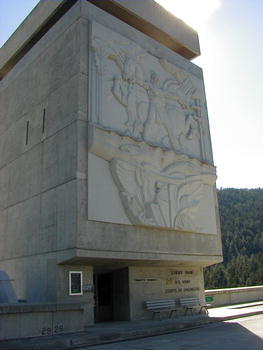
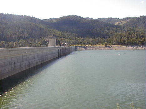
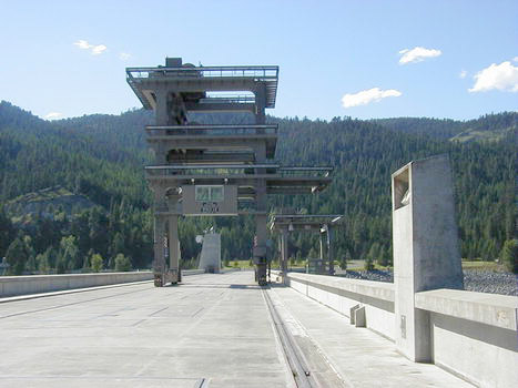
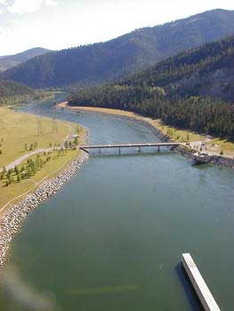
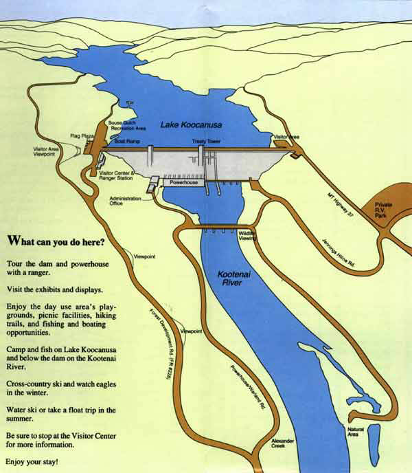
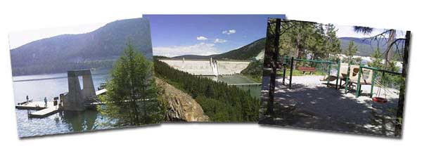
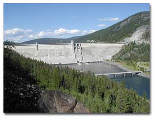
Libby Dam Visitor Center has a newly remodeled exhibit area, book/gift sales area and auditorium featuring "The Power and Beauty of the Kootenai, the Story of Libby Dam". Libby Dam Visitor Center will be open from 9:30 am to 6 pm beginning Memorial Day weekend. Guided tours of the dam and powerhouse are from the Visitor Center at 10 am, noon, 2 and 4 pm during the summer season. The visitor center is located on the west side of the dam and can be reached from the Forest Development Road (FDR) #228. The visitor parking area and boat ramp is open 24 hours a day, seven days a week during the summer. However, the top of the dam is closed to all traffic for security reasons. Libby Dam is architecturally one of the strongest and most massive types of dam built today. The dam is 422 feet tall and 3,055 feet long and was built to withstand an earthquake of up to 6.5 on the Richter scale with no structural damage. Forty-seven monolithic sections make up the dam, each one designed to stand on its own like individual dams. If one section were to fail, the other 46 would remain standing. Seismic monitoring equipment carefully monitors the dam for movement and structural integrity through one of the most thorough instrumentation systems in the United States.
During
the peak of the construction in the 1970s, Libby Dam employed over 2,000
workers.To offset the impact of the construction on nearby communities,
the Corps of Engineers build three new schools, additions to several
other schools, and the Libby airport. The town of Rexford was moved
to higher ground, where a new school, water system, sewage system, fire
station, post office and road were built.
Highway 37 was also relocated to higher ground on the east side of the
reservoir. A forest development road (FDR) was established along the
west side of the reservoir, and provides access to the streams, drainages
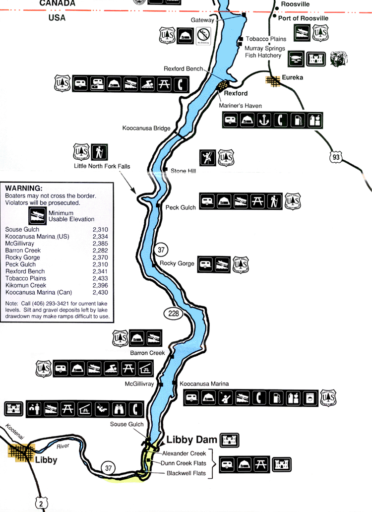
and recreational sites on the west side of the lake. Koocanusa Bridge,
Montana's longest (2,437 feet) and highest (270 feet) bridge, was built
to provide additional access across the north end of the reservoir.
The
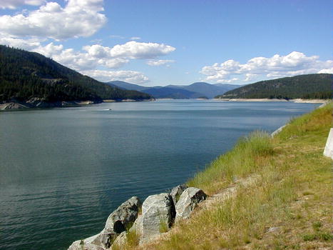
Great Northern Railroad line was also relocated, Recreation sites were built near the dam and at several locations along the lake edge. The sites at the dam are managed by the US Army Corps of Engineers. The other recreation sites are maintained by the US Forest Service. McGillivray Campground on the west side of the lake, has a boat dock, group picnic area, swimming area with sandy beach, and flush toilets. Libby Dam generators can provide enough electricity for the daily needs of 500,000 average homes. Electricity generated by the dam is sold by the Bonneville Power Administration (BPA) to customers in a 300,000 square-mile area that includes western Montana, Idaho, Washington, Oregon and parts of California, Wyoming, Utah and Nevada. Lake
Koocanusa Lake Koocanusa received its name in a contest to name the reservoir behind the dam. Alice Beers, from Rexford, Montana, combined the first three letters from KOOtenai River, and the first three letters of CANada and USA. Libby Dam has a Visitor's Center with historical displays and information about the dam, wildlife, and recreation associated with the dam and reservoir.
|
|||
|
Boaters
are reminded that each boat passenger must have a U.S. Coast Guard approved
life jacket, and children under 12 are required to wear their life jacket
at all times when boating on Montana waters. The Kootenai River is listed as a "Blue Ribbon" trout stream. As part of the Army Corps of Engineers wildlife & fisheries management programs, the Murray Springs Fish Hatchery was built in 1978 just north of Eureka. Fish raised at the hatchery are stocked in many lakes and streams in Lincoln County, including Lake Koocanusa, as well as many other waters in the state. Temperature of the Kootenai River below the dam is controlled to create ideal conditions for the growth and reproduction of trout. Populations of bald eagles, osprey, and other bird and wildlife species have thrived since the dam was built.
|
|
Other
Libby Dam web sites and contacts: Libby
Dam Visitor Center - (406) 293-5577 Libby
Dam Project Office Kootenai
National Forest |
| | HOME | AREA ATTRACTIONS | OUTDOORS | EVENTS | COMMUNITY | PHOTO GALLERY | BUSINESSES | |